ATTACHMENT 4: Searching 5 areas for possible leads on undiscovered crash sites
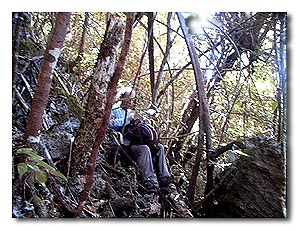
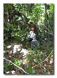
a) MAJ Nelson/LT Houle Crash Sites, 13, 17, 21, 23 April 02 The P-MAN IV team spent much of its stay on several islands between Koror and Malakal. Unlike these latter two islands, which are the most populated in the Palauas, the surrounding islands we explored, so near �civilization,� are uninhabited (except for one small compound on one island). The jungle has grown over the steep and jagged coral (called - for good reason - �porcupine� coral by the locals), rising very rapidly up to 200 feet above the ocean. The coral walls combine with the dense humid jungle and those omnipresent vines to make the going very slow and difficult. Some of these islands are frequented only by hunters, who often stick to well-worn trails.
The team was attempting to locate two possible crash sites: that of MAJ Quintus B. Nelson, USMC and that of LT Richard Houle, USN. Both remain MIA. The after action reports from Major Nelson�s mission on 16 April 45 and LT Houle�s mission of 27 April 44 place both crash sites within this general area. Having had only these vaguely worded after action reports as �guides,� previous BentProp attempts to locate these sites over the past several years have been unsuccessful.
However, before this trip, Jim Nelson had provided us with one new lead: he had a letter from his uncle, a WWII Naval officer who served on an aircraft carrier, who had drawn a map based on a discussion he had had with a VMF-121 aviator on a mission nearby that day. While the map is difficult to relate to actual geographic structures, it clearly shows MAJ Nelson�s Corsair crashing on an island and not in the water. Without further leads, we decided to place our bets on two islands: Ngermalk and Arupushukaru (Japanese name for Ulebsechel). Jim Nelson, on his own quest to learn more about (and possibly to find) his still-missing father, accompanied the P-MAN IV team throughout the exploration of these islands. In the process, Jim became an inspiration for us all.
 We
first explored the smaller of the two islands. Ngermalk in some respects
is a boulderer�s dream. Although a small island (at its widest points,
~ 1000 X 600 yards) there are many routes, which can tempt climbers of
all skill levels because of the multiple handholds the porous coral offers.
Walls, cracks, and huge coral boulders abound on this island (as well
as those nearby). But the jungle and coral add certain negatively synergistic
twists, which can turn a dream climb into real and serious work. One Palauan
who has followed my work for years expressed concern - the first time
ever - for our physical well being when I mentioned our plans to search
these islands. We learned all too soon, as his concerns quickly became
our burdens.
We
first explored the smaller of the two islands. Ngermalk in some respects
is a boulderer�s dream. Although a small island (at its widest points,
~ 1000 X 600 yards) there are many routes, which can tempt climbers of
all skill levels because of the multiple handholds the porous coral offers.
Walls, cracks, and huge coral boulders abound on this island (as well
as those nearby). But the jungle and coral add certain negatively synergistic
twists, which can turn a dream climb into real and serious work. One Palauan
who has followed my work for years expressed concern - the first time
ever - for our physical well being when I mentioned our plans to search
these islands. We learned all too soon, as his concerns quickly became
our burdens.
Once on Ngermalk, we discovered that the dense, tall jungle canopy hid an island floor not revealed on the USGS topo map. Many coral peaks appeared that required exploration. The result is that the team broke up into two and sometimes four subgroups to cover the much larger-than-expected surface area. We found several Japanese bunkers scattered throughout the island. But in the end, after consuming many gallons of Gatorade® and most of my first aid kit, we did not find one scrap of evidence on that island to suggest that an American aircraft might have crashed there. But such negative evidence is evidence: Ngermalk now is one less island we have to search in the future.
We expanded our exploration to Ulebsechel. Joe spread the word around Koror about our search and several Palauans reported to us that aircraft debris had been seen somewhere along the ridgeline of this long island. We began our search on the most western end of the island, near the Japanese boat repair works and while we found a number of interesting artifacts most likely related to the Japanese occupation, our preliminary search was negative. We did find a small aircraft-related debris field, as yet unidentified, along the water�s edge of the boat repair area, mentioned above in Attachment 2 b. At the recommendation of Palauan elders, we then began working with Vernon, a young hunter who recalled seeing wreckage a few years back. Vernon selected a starting point along the shoreline and we started climbing. On top, we split into two groups and searched carefully on both sides of the ridge without success. That day, the day after our memorial for MAJ Nelson (see below, Attachment 7), we all stopped at 1100, along with Jim Nelson, to watch the VMF-225 F-18 �Missing Man� flyby in tribute to his father. Not able to see them through the dense canopy overhead, we heard them well. We continued on looking until exhaustion, finding nothing. Later Dan O�Brien calculated that over the entire day�s mission, we had traveled no more than a linear quarter mile.
 Because
we could not be seen from the water, I called in Joe by radio to bring
the boat to a position below us. At our exit point at the base of the
island, I identified a bombed out Japanese Daihatsu landing craft hidden
behind a small island just off shore. This was one of the many �barges�
that the USMC aviators spent so much time hunting in Palau � and may even
represent the work of MAJ Nelson. While unsuccessful thus far in finding
either aircraft wreck on these islands, our search patterns were methodical,
and will allow us to narrow down future searches in this area.
Because
we could not be seen from the water, I called in Joe by radio to bring
the boat to a position below us. At our exit point at the base of the
island, I identified a bombed out Japanese Daihatsu landing craft hidden
behind a small island just off shore. This was one of the many �barges�
that the USMC aviators spent so much time hunting in Palau � and may even
represent the work of MAJ Nelson. While unsuccessful thus far in finding
either aircraft wreck on these islands, our search patterns were methodical,
and will allow us to narrow down future searches in this area.
One final thought: these hills of Palau lie
further away from Jim Nelson�s home than can be expressed by the mere
separation of a few thousands of miles. Much more accustomed to golf courses
than jungles, Jim took his licks and kept on marching just like the rest
of us, never complaining or quitting, as he looked tirelessly for his
father. The search for missing airmen in Palau is more often than not
frustrated by failure; however, in the future, on that rare occasion when
any of us might be tempted to falter, Jim�s example will provide us all
the resolve we need. For that, Jim, we thank you.